Monitoring for Operational Wind Farms
Detect collisions and bird interactions around wind turbines to build a robust evidence base for compliance and avoid unnecessary curtailment.


Trusted by industry leaders

Reduce Risks Across the Entire Wind Farm Lifecycle
Challenge
Due to limited survey data, buffer zones often remove significant areas of developable land. With regulators relying on as little as 70–80 survey hours per year, buffers are routinely oversized – reducing turbine count and undermining energy yield.
Solution
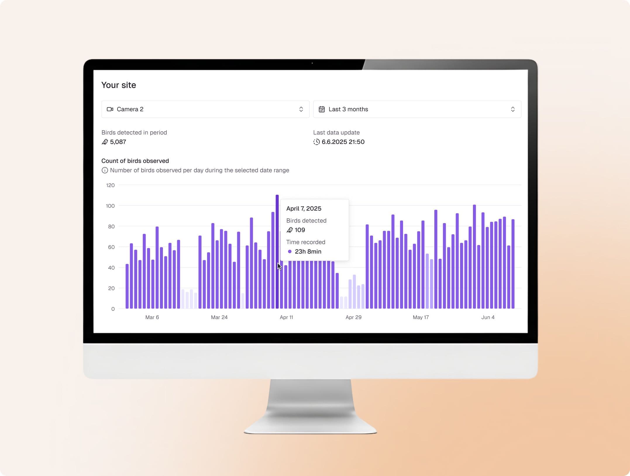
Continuous bird and bat monitoring delivering 4,000+ daytime hours (8,000+ including bats), with AI-driven species identification, 3D flight path mapping, and actual collision risk assessment.
Outcomes
- Unlock restricted land and add turbines safely
- Reduce or eliminate oversized buffer zones
- Improve layout flexibility, minimise curtailment, and increase annual energy production
- Accelerate permitting with transparent, regulator-ready data available via Sky Intelligence Platform

MissingMissingcriticalcriticalbirdbirddatadataleadsleadstotoconservativeconservativeassumptions,assumptions,unnecessaryunnecessarycurtailment,curtailment,andandreducedreducedenergyenergyyield.yield.
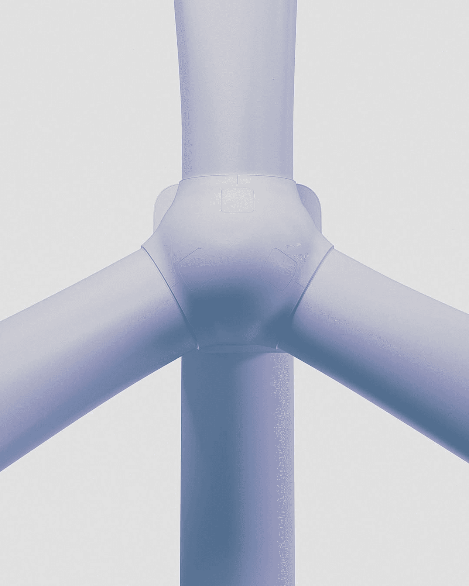
Turbine Interaction Monitoring
Continuous detection of bird interactions with wind turbines, turning video recordings into data used for collision risk assessment, avoidance behaviour analysis, and curtailment design. Key capabilities:
- Detects birds in the detection zone, tracks each one, and calculates 3D position, flight direction, and flight height
- Calculates each bird's position relative to the turbine and rotor swept zone, and determines when a bird enters the collision risk zone
- Saves every detected flight as an annotated track video and image, labelled with turbine interaction status and bird species
- Correlates bird activity with wind speed and prevailing wind direction using meteorological data


Data Consumption via Sky Intelligence Platform
Monitoring, AI detection, human validation, and contextual modelling are unified in a single platform – supporting decisions across the full wind farm lifecycle.
- Analytical support via correlation with weather, radar and historical bird activity data
- Report-ready tables and figures for EIA submissions
- Easy data exports for consultants and regulators

“This will greatly improve our understanding of collision risk and strengthen impact assessment.”
Aonghais Cook
Senior Principal Consultant at The Biodiversity Consultancy
“It has provided us with a reliable record of bird activity around offshore assets that cannot be achieved with traditional survey methods.”
Rob Iredale
Ornithology Manager at Ocean Winds
Zero collisions in 19 months: what the Aberdeen Bay data tells us about seabird behaviour and offshore wind
Continuous monitoring at Vattenfall's Aberdeen Bay offshore wind farm tracked over 137,000 birds in 19 months and recorded zero confirmed collisions.

Report
Review of Aberdeen Bay Collision Monitoring Data

Featured Collaborations and Customer Stories
Spoor partners with leading consultancies, infrastructure providers, and OEMs worldwide to scale smarter wildlife monitoring. The aim of each project is to help developers reach their permitting, delivery, and biodiversity goals.

Mounted on Fugro buoy, Spoor demonstrates high performance capability in all weather conditions, proving the feasibility of AI-driven biodiversity monitoring at deep-sea sites.

A British Trust for Ornithology evaluates the accuracy, reliability, and application of Spoor's systems for monitoring bird activity at sea, offering insights for developers and regulators seeking scalable, evidence-based monitoring solutions.

WISE Group brings its offshore operations experience to the partnership, with the system design, installation, and operational expertise needed to deliver reliable monitoring in the most demanding offshore and onshore conditions.
Step by step implementation
- 1Scope the project around regulatory requirements
- 2Collect data and combine it with wind and turbine data for full context
- 3Export datasets for environmental consultancies and regulators
- 4Stay compliant while reducing biodiversity risk

Reduce Biodiversity Risks with Spoor
Talk to one of our experts to find the best solution for your needs